

THE EQUITY’s newsroom has compiled a list of some of the most beautiful and accessible places to get out for a swim, hike or to camp overnight without having to leave the county. Though this list is not comprehensive, we hope it can lead you somewhere you haven’t yet been this summer.
Oiseau Rock Trail
Location: chemin Schyan, Sheenboro
Length: 9 km
Difficulty: Medium
Access fee: $12, payable to ZEC Saint-Patrice
The Oiseau Rock Trail is a 9-km round-trip hike through the forest to an incredible lookout on the Ottawa River. It is also the location of Algonquin pictographs on the face of the cliffs that tower over the river. There is a small swimmable lake at the top, which may or may not have a rope swing. The trail is located just over 6 km up ch. Schyan. There is a road that leads toward the trailhead (46.040761, -77.277080), but it can be bumpy. An SUV or high clearance vehicle is recommended to access the site. Allow yourself 3-3.5 hours at a solid pace, but if you choose to park alongside the road, this will add time to the walk.
Luskville Falls (Gatineau Park)
Location: chemin de l’Hôtel de Ville, Luskville
Length: 4.2 km

Difficulty: Medium
Access fee: Free
Luskville Falls trail is a 4.2 km loop, and features a steep climb up the side of the rocky slopes of the Eardley Escarpment. With a 300-metre elevation gain, the trail is a steep climb, but hikers are rewarded with several lookout points onto the Ottawa River and the surrounding countryside. A fire tower built in 1940 is located at the northern end of the trail. In the past, forest rangers used it to monitor the horizon for signs of forest fires. Good sneakers or hiking shoes are recommended.
Pontiac Pacific Junction Trail (PPJ)
Location: L’Isle-aux-Allumettes to Bristol
Length: 92 km
Difficulty: Easy
Access fee: Free

The Pontiac Pacific Junction (PPJ) trail traverses most of the length of MRC Pontiac, stretching from Cottage Rd. on L’Isle-aux-Allumettes to chemin Gold Mine N in Bristol. Along the way, trail-goers will encounter beautiful vistas of the Ottawa River, rolling farmland and tranquil forested stretches as the trail snakes its way through Pontiac’s towns. This trail for walkers and cyclists – share the trail.
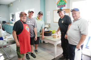
Chutes Coulonge Park
Location: 100 prom. Du-Parc-des-Chutes, Mansfield-et-Pontefract
Length: Three trails, each 1-2 km long
Difficulty: Easy to Medium
Access fee: $12 for adults, $10 for visitors over 65 and under 18
The Chutes Coulonge is an outdoor park featuring impressive waterfalls, suspension bridges, adventure activities, and three scenic hiking trails. The 1.2-km Historical Trail leads to the gem of the park: the 42-metre-high Chutes Coulonge. Signage along the way will explain the region’s log driving history. The 1-km Beaver Trail leads visitors through a quieter section of the park, above the roar of the rapids, and visitors may even spot some beavers along the way. Finally, the more challenging Blue Heron Trail is a 2-km loop through the forest.
Mont O’Brien Trail
Location: chem. Mont-O’Brien, Alleyn-et-Cawood
Length: 5 km
Difficulty: Easy to Medium
Access fee: Free
Located in the protected Mont O’Brien biodiversity reserve, the Mary Haydon trail snakes through the forest before ascending Mont O’Brien. The trail gives hikers beautiful views of the surrounding landscape, opportunities for bird watching and more.
Tote Road Trail (Dumoine River)
Location: Dumoine River, access from Rapides-des-Joachims
Length: 26 km, possible to hike individual segments of the trail
Difficulty: Easy to Difficult
Access fee: Yes, payable to ZEC Dumoine
The Tote Road Trail is a 26-km hiking trail along the Dumoine River. It follows a historic logging trail that has been reopened thanks to the efforts of local volunteers. Various day-hike options are available, some accessible by vehicle while others only accessible by boat. Multi-day backpacking trips are also possible along this trail. You’ll be walking along a river, so naturally, there will be swimming opportunities. Just be careful around rapids. For more information on recommended routes, safety tips and how to access the trails, visit friendsofdumoine.ca.
Island Trails
Location: Rapides-des-Joachims
Length: over 40 km
Difficulty: Easy
Access fee: Free
A network of walking and hiking trails located on and around the Rapides-des-Joachims island, offering forest scenery and river views. The trails are suitable for casual hikes and family outings. If you’re looking for a swim, one trail will bring you to the beach at Camping McConnell (see entry below). For a map and list of the trails, visit the Municipality of Rapides-des-Joachims’ website.
Norway Bay Beach
Location: ch. Wharf, Bristol
Access fee: Free
Located in the heart of Norway Bay, next to the iconic pier, the beach offers a large shallow swimming area, often monitored by a life guard, as well as docks in deeper water for those looking to swim. The site also has washrooms, picnic benches, and a wheelchair mat ramp down to the water.
Bryson Beach
Location: rue Wellington, Bryson
Access fee: Free
This municipally maintained beach along the Ottawa River is equipped with picnic tables, volleyball nets, and portable washrooms. A wheelchair access mat helps improve accessibility, making the beach more welcoming for all visitors.
Fort William Beach
(Hotel Pontiac)
Location: 7 ch. Perrault, Sheenboro
Access fee: Free
Located on one of the finest patches of sand along the Ottawa River in Sheenboro, Hotel Pontiac, commonly known as The Fort, is a community hub and former Hudson Bay Company trading post. The beach is accessible by land or water, with plenty of space for parking a boat. The venue hosts activities and events throughout the summer. More information at welcometothefort.ca
Côte Jaune Beach
Location: ch. Des Iroquois, l’Île-du-Grand-Calumet
Access fee: Free
Plage Côte Jaune, on l’Île-du-Grand-Calumet’s northern tip, is named after
the distinctive yellow colouring of the hillside. The water becomes deep relatively quickly, and swimming is at your own risk. The site includes a portable toilet and a small
changing area.
Parc Leslie
Location: 460 ch. Belmont, Otter Lake
Day access fee: $12/adult
Access to the park, including beach access, is $12/adult, and free for people under 18. The beach is huge, the water stays shallow for a long stretch, and dogs are welcome. You can swim, rent a canoe or kayak, or launch your own boat, just make sure to stop at the boatwashing station in town first. This park also offers camping options for tents and RVs. More information at parcleslie.com or by calling 819-453-7382.
Lac Dumont
Location: ch. de l’Aigle, Cayamant
Access fee: $10 – $20
The Lac Dumont beach is located in Pontiac’s TNO Lac-Nilgaut, almost two hours north of Shawville on backcountry roads. The pristine beach is maintained by the non-profit group Amis du Lac Dumont. Day passes are $10 per adult and $20 per adult for overnight rustic camping. Children under 18 are admitted free. Pets welcome. Dry toilets on site. For more information, contact lesamiesdulacdumont@gmail.com.
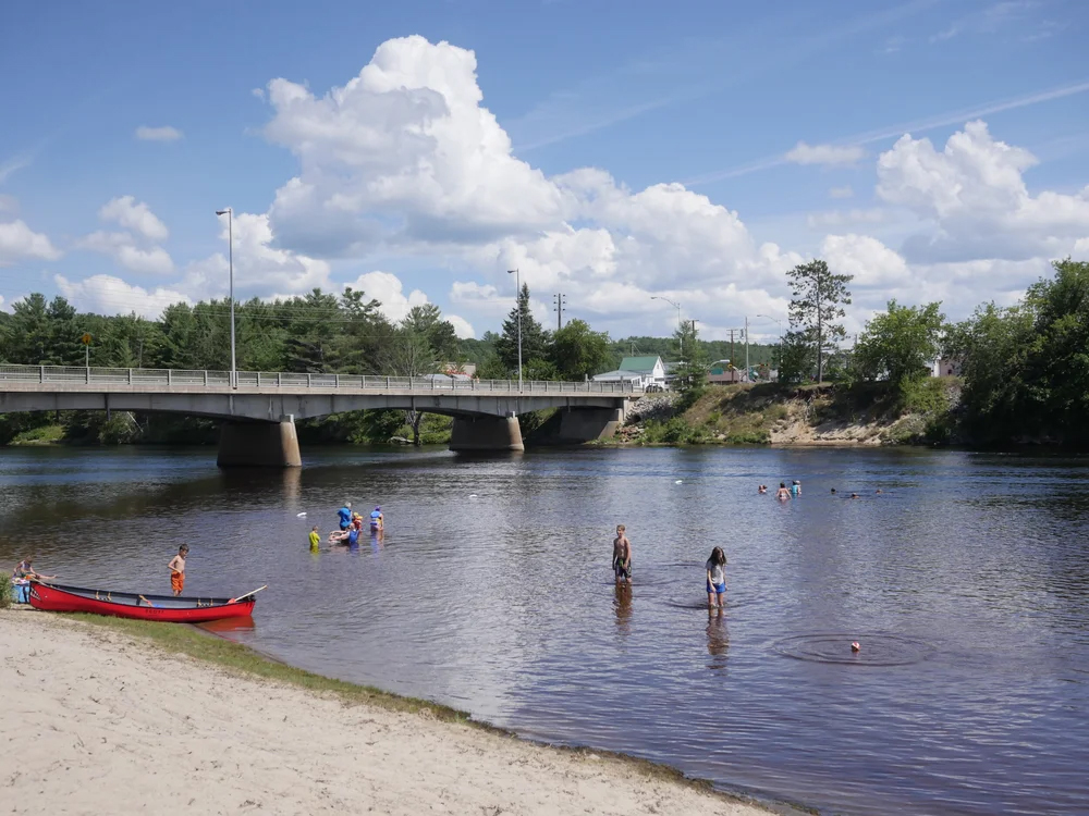
Plage du Pont Blanc
Location: 257 rue Principale (Hwy. 148), Mansfield-et-Pontefract
Access fee: Free
The Pont Blanc beach, right off the highway in downtown Mansfield-et-Pontefract, is a gorgeous sandy beach on the Coulonge River. Axe throwing and other adventure activities are available throughout the summer months at a cost. Campsites and RV parking are available by reservation, starting at $30/night. For more information visit cooperativehelianthe.com or call (613) 401-2997.
Camping McConnell
Location: 228 ch. Du Lac McConnell, Rapides-des-Joachims
Access fee: $42/night for tent site
Camping McConnell is located on the sandy banks of the Ottawa River in Pontiac’s western-most municipality of Rapides-des-Joachims. The campground offers sites for tents, trailers and RVs, as well as a picnic area, and boat launch, and access to a 40-km network of walking trails. More information is available at https://municipalites-du-quebec.ca/rapides-des-joachims/camping.php.
Public Land Camping (TNO Lac-Nilgaut)
Location: TNO Lac-Nilgaut
Access fee: Free
Camping in the MRC Pontiac’s unorganized territories offers a true back to nature experience on public Crown land. It’s ideal for self-sufficient campers looking for solitude, remote landscapes, and access to lakes, rivers, and forested areas. Keep in mind that in remote areas, an emergency means rescue, not roadside assistance. Services can be far away, and you must be prepared to rely on yourself. Before you head out, remember: in nature, your safety is your responsibility. Anyone wishing to camp with a motorized vehicle must obtain a permit from the MRC and pay the required camping fees. Visit https://mrcpontiac.qc.ca/en/visitors/camping/ for more information.
La rédaction de THE EQUITY a dressé une liste des plus beaux et des plus accessibles endroits pour nager, faire de la randonnée ou camper sans avoir à quitter le comté. Bien que cette liste ne soit pas exhaustive, nous espérons qu’elle pourra vous faire découvrir un endroit où vous n’êtes pas encore allé cet été.
Sentier de l’Oiseau Rock
Lieu : chemin Schyan, Sheenboro
Longueur : 9 km
Difficulté : Moyenne
Frais d’accès : 12 $, payable à la ZEC Saint-Patrice
Le sentier de l’Oiseau Rock est une randonnée aller-retour de 9 km à travers la forêt jusqu’à un point de vue incroyable sur la rivière des Outaouais. C’est aussi l’emplacement de pictogrammes algonquins sur la paroi des falaises qui surplombent la rivière. Il y a un petit lac où l’on peut se baigner au sommet, qui peut ou non avoir une balançoire de corde. Le sentier est situé à un peu plus de 6 km sur le chemin Schyan. Il y a une route qui mène au début du sentier (46.040761, -77.277080), mais elle peut être cahoteuse. Un VUS ou un véhicule à garde au sol élevée est recommandé pour accéder au site. Prévoyez 3 à 3,5 heures à un bon rythme, mais si vous choisissez de vous garer le long de la route, cela ajoutera du temps à la marche.
Chutes de Luskville (Parc de la Gatineau)
Lieu : chemin de l’Hôtel de Ville, Luskville
Longueur : 4,2 km
Difficulté : Moyenne
Frais d’accès : Gratuit
Le sentier des Chutes de Luskville est une boucle de 4,2 km qui présente une montée abrupte le long des pentes rocheuses de l’escarpement d’Eardley. Avec un dénivelé de 300 mètres, le sentier est une montée difficile, mais les randonneurs sont récompensés par plusieurs points de vue sur la rivière des Outaouais et la campagne environnante. Une tour d’observation des incendies construite en 1940 est située à l’extrémité nord du sentier. Autrefois, les gardes forestiers l’utilisaient pour surveiller l’horizon à la recherche de signes de feux de forêt. De bonnes chaussures de sport ou de randonnée sont recommandées.
Sentier Pontiac Pacific Junction (PPJ)
Lieu : L’Isle-aux-Allumettes à Bristol
Longueur : 92 km
Difficulté : Facile
Frais d’accès : Gratuit
Le sentier Pontiac Pacific Junction (PPJ) traverse la majeure partie de la MRC de Pontiac, s’étendant du chemin Cottage sur L’Isle-aux-Allumettes au chemin Gold Mine N à Bristol. En chemin, les usagers du sentier découvriront de magnifiques panoramas sur la rivière des Outaouais, des terres agricoles vallonnées et des étendues forestières tranquilles tandis que le sentier serpente à travers les villes de Pontiac. Ce sentier est pour les marcheurs et les cyclistes – partagez le sentier.
Parc des Chutes Coulonge
Lieu : 100 prom. Du-Parc-des-Chutes, Mansfield-et-Pontefract
Longueur : Trois sentiers, chacun de 1 à 2 km de long
Difficulté : Facile à moyenne
Frais d’accès : 12 $ pour les adultes, 10 $ pour les visiteurs de plus de 65 ans et de moins de 18 ans
Le parc des Chutes Coulonge est un parc extérieur qui offre des chutes impressionnantes, des ponts suspendus, des activités d’aventure et trois sentiers de randonnée panoramiques. Le Sentier Historique de 1,2 km mène au joyau du parc : les Chutes Coulonge, hautes de 42 mètres. La signalisation le long du parcours expliquera l’histoire du flottage du bois dans la région. Le Sentier des Castors de 1 km emmène les visiteurs à travers une section plus tranquille du parc, au-dessus du bruit des rapides, et les visiteurs pourraient même apercevoir des castors en chemin. Enfin, le Sentier du Grand Héron, plus exigeant, est une boucle de 2 km à travers la forêt.
Sentier du Mont O’Brien
Lieu : chem. Mont-O’Brien, Alleyn-et-Cawood
Longueur : 5 km
Difficulté : Facile à moyenne
Frais d’accès : Gratuit
Situé dans la réserve de biodiversité protégée du Mont O’Brien, le sentier Mary Haydon serpente à travers la forêt avant d’ascensionner le Mont O’Brien. Le sentier offre aux randonneurs de magnifiques vues sur le paysage environnant, des opportunités d’observation des oiseaux et plus encore.
Sentier Tote Road (Rivière Dumoine)
Lieu : Rivière Dumoine, accès depuis Rapides-des-Joachims
Longueur : 26 km, il est possible de parcourir des segments individuels du sentier
Difficulté : Facile à difficile
Frais d’accès : Oui, payable à la ZEC Dumoine
Le sentier Tote Road est un sentier de randonnée de 26 km le long de la rivière Dumoine. Il suit une ancienne piste de portage forestière qui a été rouverte grâce aux efforts de bénévoles locaux. Diverses options de randonnées d’une journée sont disponibles, certaines accessibles en véhicule tandis que d’autres ne le sont qu’en bateau. Des randonnées de plusieurs jours avec sac à dos sont également possibles le long de ce sentier. Vous marcherez le long d’une rivière, il y aura donc naturellement des possibilités de baignade. Soyez juste prudent autour des rapides. Pour plus d’informations sur les itinéraires recommandés, les conseils de sécurité et comment accéder aux sentiers, visitez friendsofdumoine.ca.
Sentiers de l’Île
Lieu : Rapides-des-Joachims
Longueur : plus de 40 km
Difficulté : Facile
Frais d’accès : Gratuit
Un réseau de sentiers pédestres et de randonnée situés sur et autour de l’île de Rapides-des-Joachims, offrant des paysages forestiers et des vues sur la rivière. Les sentiers conviennent aux randonnées occasionnelles et aux sorties en famille. Si vous cherchez à vous baigner, un sentier vous mènera à la plage du Camping McConnell (voir l’entrée ci-dessous). Pour une carte et une liste des sentiers, visitez le site web de la Municipalité de Rapides-des-Joachims.
Plage de Norway Bay
Lieu : ch. Wharf, Bristol
Frais d’accès : Gratuit
Située au cœur de Norway Bay, à côté de la jetée emblématique, la plage offre une grande zone de baignade peu profonde, souvent surveillée par un sauveteur, ainsi que des quais en eau plus profonde pour ceux qui souhaitent nager. Le site dispose également de toilettes, de tables de pique-nique et d’une rampe d’accès à l’eau pour fauteuils roulants.
Plage de Bryson
Lieu : rue Wellington, Bryson
Frais d’accès : Gratuit
Cette plage entretenue par la municipalité le long de la rivière des Outaouais est équipée de tables de pique-nique, de filets de volleyball et de toilettes portables. Un tapis d’accès pour fauteuils roulants contribue à améliorer l’accessibilité, rendant la plage plus accueillante pour tous les visiteurs.
Plage de Fort William
(Hôtel Pontiac)
Lieu : 7 ch. Perrault, Sheenboro
Frais d’accès : Gratuit
Située sur l’une des plus belles étendues de sable le long de la rivière des Outaouais à Sheenboro, l’Hôtel Pontiac, communément appelé The Fort, est un centre communautaire et un ancien poste de traite de la Compagnie de la Baie d’Hudson. La plage est accessible par terre ou par eau, avec beaucoup d’espace pour garer un bateau. Le site accueille des activités et des événements tout au long de l’été. Plus d’informations sur welcometothefort.ca
Plage de la Côte Jaune
Lieu : ch. Des Iroquois, l’Île-du-Grand-Calumet
Frais d’accès : Gratuit
La plage Côte Jaune, à la pointe nord de l’Île-du-Grand-Calumet, est nommée d’après
la coloration jaune distinctive du flanc de la colline. L’eau devient profonde assez rapidement, et la baignade est à vos risques et périls. Le site comprend une toilette portable et un petit
vestiaire.
Parc Leslie
Lieu : 460 ch. Belmont, Otter Lake
Frais d’accès journalier : 12 $/adulte
L’accès au parc, y compris l’accès à la plage, est de 12 $/adulte et gratuit pour les personnes de moins de 18 ans. La plage est immense, l’eau reste peu profonde sur une longue distance, et les chiens sont les bienvenus. Vous pouvez nager, louer un canot ou un kayak, ou lancer votre propre bateau, assurez-vous simplement de passer par la station de lavage de bateaux en ville d’abord. Ce parc propose également des options de camping pour tentes et VR. Plus d’informations sur parcleslie.com ou en composant le 819-453-7382.
Lac Dumont
Lieu : ch. de l’Aigle, Cayamant
Frais d’accès : 10 $ – 20 $
La plage du Lac Dumont est située dans le TNO Lac-Nilgaut du Pontiac, à près de deux heures au nord de Shawville sur des routes secondaires. La plage immaculée est entretenue par le groupe à but non lucratif Amis du Lac Dumont. Les laissez-passer journaliers sont de 10 $ par adulte et de 20 $ par adulte pour le camping rustique de nuit. Les enfants de moins de 18 ans sont admis gratuitement. Animaux de compagnie bienvenus. Toilettes sèches sur place. Pour plus d’informations, contactez lesamiesdulacdumont@gmail.com.
Plage du Pont Blanc
Lieu : 257 rue Principale (Route 148), Mansfield-et-Pontefract
Frais d’accès : Gratuit
La plage du Pont Blanc, juste à côté de l’autoroute au centre-ville de Mansfield-et-Pontefract, est une magnifique plage de sable sur la rivière Coulonge. Le lancer de hache et d’autres activités d’aventure sont disponibles tout au long des mois d’été moyennant des frais. Des emplacements de camping et de stationnement pour VR sont disponibles sur réservation, à partir de 30 $/nuit. Pour plus d’informations, visitez cooperativehelianthe.com ou composez le (613) 401-2997.
Camping McConnell
Lieu : 228 ch. Du Lac McConnell, Rapides-des-Joachims
Frais d’accès : 42 $/nuit pour un emplacement de tente
Le Camping McConnell est situé sur les berges sablonneuses de la rivière des Outaouais, dans la municipalité la plus à l’ouest du Pontiac, Rapides-des-Joachims. Le camping offre des emplacements pour tentes, roulottes et VR, ainsi qu’une aire de pique-nique, une rampe de mise à l’eau et un accès à un réseau de sentiers pédestres de 40 km. Plus d’informations sont disponibles sur https://municipalites-du-quebec.ca/rapides-des-joachims/camping.php.
Camping sur les terres publiques (TNO Lac-Nilgaut)
Lieu : TNO Lac-Nilgaut
Frais d’accès : Gratuit
Le camping dans les territoires non organisés de la MRC de Pontiac offre une véritable expérience de retour à la nature sur les terres publiques de la Couronne. C’est idéal pour les campeurs autonomes à la recherche de solitude, de paysages éloignés et d’accès aux lacs, rivières et zones forestières. Gardez à l’esprit que dans les zones éloignées, une urgence signifie un sauvetage, et non une assistance routière. Les services peuvent être éloignés, et vous devez être prêt à compter sur vous-même. Avant de partir, souvenez-vous : dans la nature, votre sécurité est votre responsabilité. Toute personne souhaitant camper avec un véhicule motorisé doit obtenir un permis de la MRC et payer les frais de camping requis. Visitez https://mrcpontiac.qc.ca/en/visitors/camping/ pour plus d’informations.