The Coalition Avenir Quebec (CAQ) is still in the infancy of it’s first time leading the provincial government, and does it ever show.
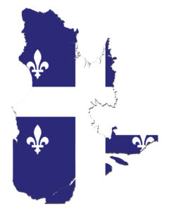
On June 17, the province revealed a revised map of the flood plains throughout the province, which was instantly panned.
To top things off, the government recessed for summer vacation after issuing the new map.
Municipal leaders decried a lack of communication or consultation with the province.
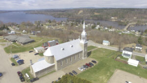
Here in the Pontiac, Fort Coulonge Mayor Gaston Allard said that nearly half of the town is now in the province’s newly created Special Intervention Zone.
These Special Intervention Zones placed a freeze on any construction on structures within the ZIS.
This means that anyone trying to repair their homes in the wake of the spring floods are now in a holding pattern. Additionally, any ongoing construction in those zones will have to come to a halt.
The CAQ government has made a mess of a file that affects a massive number of people in a significant way. People have been forced from their homes, businesses are waiting in limbo to get a green light to continue with projects and homeowners don’t know if they’ll be able to stay on their properties.
And the rookie government hasn’t helped all the confusion.
When the map was originally released, the consultation sessions were meant to inform the public only. But in anticipation of the backlash, the province decided at the last minute that input from residents and municipal leaders will be taken into consideration when the new map is released in “mid-July” with the province’s permanent decree.

Nobody is really clear on when in “mid-July” the province will release the map.
Not only that, but as Pontiac Liberal MNA André Fortin pointed out, this timetable gives the province 11 days from the time of the meeting to its stated deadline to go over the input from the consultations and make changes to the map – all while MNAs are on summer vacation.
Fortin put it mildly when he said the map was “poorly thought-out.”
For instance, in Gatineau, a multi-million dollar condo development that wasn’t affected by the floods in 2017 and 2019 is included in the ZIS, putting the project at risk.
The province has eroded municipal independance by applying a new flood plain to a region seemingly arbitrarily. Who better to judge flood plains than those who were the boots-on-the-ground responding to the disaster and saw it first hand?

At the very least, the province could have asked for some kind of input.
To confuse matters even more, the deadline for residents and politicians to give feedback to the province about the new map is Aug. 19 – somewhere around a month after the new map is made public in the government’s permanent decree.
This marks the second time in three years that the flood map has been updated, and provincial staff said there’s no guarantee there won’t be more of them in the future.
If the experts are redrawing the lines more frequently than some people visit the dentist, how much trust should residents put into the accuracy of these maps?
And if they can’t trust the accuracy of the maps, how can they trust the politicians to fix it when they were the ones who gave it the okay and promptly started their summer vacations?
There is a big difference between criticizing from the peanut gallery and actually taking the reins.
The CAQ is finding this out in real time.
Chris Lowrey