Update: this story has been updated from its original version to include more current forecasts.
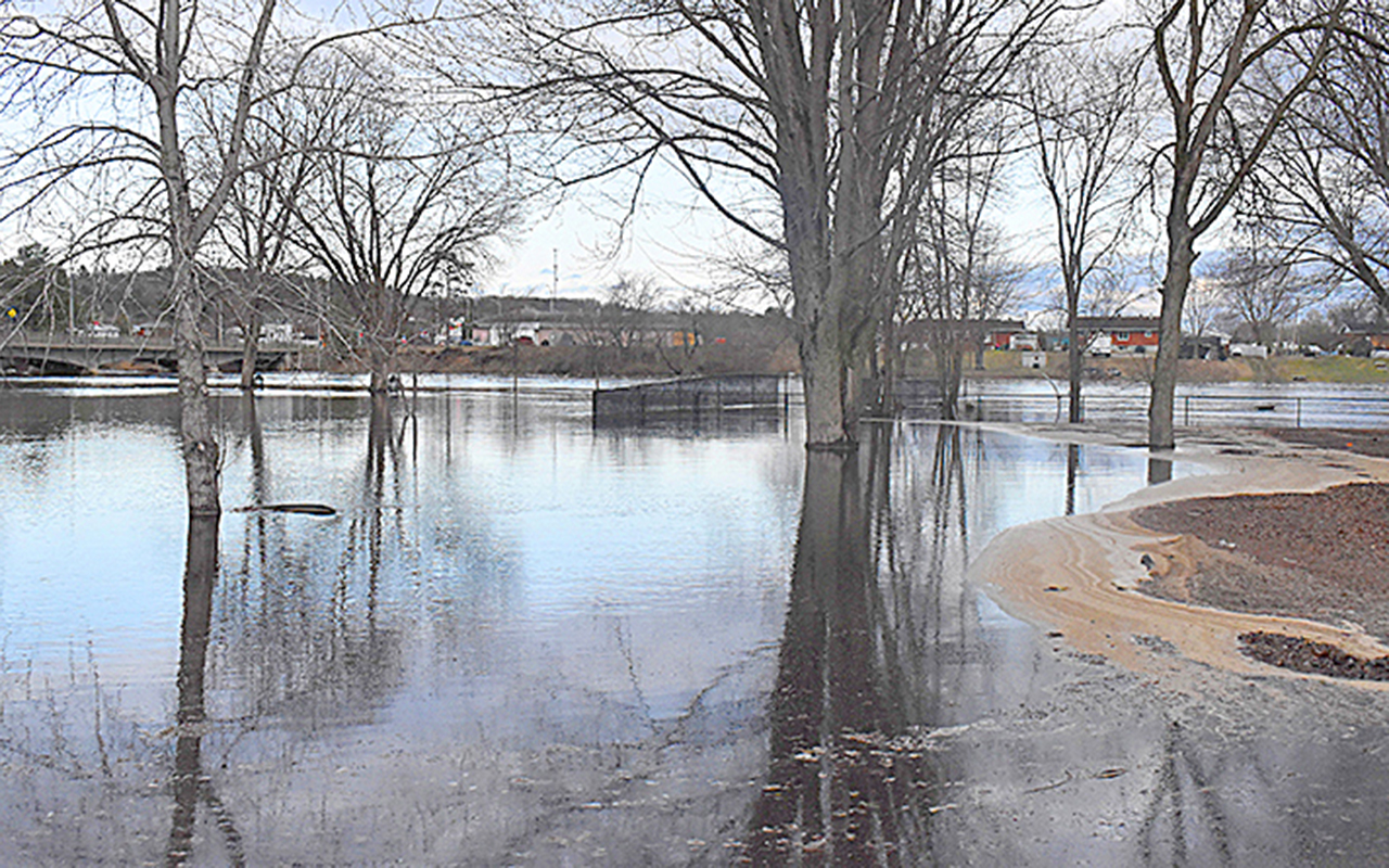
The Ottawa River Regulation Planning Board issued a statement on Apr. 14 forecasting a rapid increase in river levels from Pembroke to Montreal due to the heavy rainfall that began Sunday evening.
“Water levels and flows are increasing rapidly at all locations along the main stem of the Ottawa River due to recent rainfall combined with significant snowmelt from the unregulated portion of the basin,” the statement reads.
“Minor flood levels may be exceeded in flood prone areas along the Ottawa River between Pembroke and Masson/Cumberland over the next few days.”
The planning board defines the minor flood level as the level at which “parts of some streets, lawns and parks are beginning to flood, with no or few houses/buildings being affected.”
An Apr. 13 press release from the planning board offers a more detailed explanation as to the rise in water levels expected this week.
“Over the next five days, warmer temperatures are expected to cause rapid snowmelt in the southern
part of the basin where snow remains (e.g. Petawawa River), as well as increased snowmelt in subbasins north of the Ottawa River (e.g. Coulonge and Rouge rivers),” it says.
“Combined with forecast rainfall of 30 to 60 mm over the next few days across the basin, water levels and flows are expected to rise significantly and may exceed flood levels in many locations later this week.”
The Pembroke district of Ontario’s Ministry of Natural Resources also issued a flood warning on Apr. 14, in effect from Pembroke to Arnprior until Apr. 17, unless otherwise updated.
It warns water levels “may exceed flood levels in flood prone locations later this week,” and advises residents that have been affected by high water levels in the past to secure vulnerable property near rivers and lakes and monitor conditions throughout the week.

More detailed information and up-to-date forecasts are available via www.ottawariver.ca.
Mise à jour : cet article a été mis à jour par rapport à sa version originale pour inclure des prévisions plus récentes.
La Commission de planification de la régularisation de la rivière des Outaouais a publié un communiqué le 14 avril prédisant une augmentation rapide des niveaux de la rivière de Pembroke à Montréal en raison des fortes pluies qui ont commencé dimanche soir.
« Les niveaux d’eau et les débits augmentent rapidement à tous les endroits le long du cours principal de la rivière des Outaouais en raison des récentes pluies combinées à la fonte importante des neiges dans la partie non régularisée du bassin », indique le communiqué.
« Les niveaux de crue mineurs pourraient être dépassés dans les zones sujettes aux inondations le long de la rivière des Outaouais entre Pembroke et Masson/Cumberland au cours des prochains jours. »
La commission de planification définit le niveau de crue mineur comme le niveau auquel « des parties de certaines rues, pelouses et parcs commencent à être inondées, sans ou avec peu de maisons/bâtiments affectés. »
Un communiqué de presse du 13 avril de la commission de planification offre une explication plus détaillée de la montée des niveaux d’eau prévue cette semaine.
« Au cours des cinq prochains jours, des températures plus chaudes devraient provoquer une fonte rapide des neiges dans la partie sud
du bassin où la neige persiste (par ex. la rivière Petawawa), ainsi qu’une fonte accrue des neiges dans les sous-bassins au nord de la rivière des Outaouais (par ex. les rivières Coulonge et Rouge), » est-il indiqué.

« Combinées à des précipitations prévues de 30 à 60 mm au cours des prochains jours dans l’ensemble du bassin, les niveaux d’eau et les débits devraient augmenter considérablement et pourraient dépasser les niveaux de crue à de nombreux endroits plus tard cette semaine. »
Le district de Pembroke du ministère des Richesses naturelles de l’Ontario a également émis un avertissement d’inondation le 14 avril, en vigueur de Pembroke à Arnprior jusqu’au 17 avril, sauf mise à jour contraire.
Il avertit que les niveaux d’eau « pourraient dépasser les niveaux de crue dans les zones sujettes aux inondations plus tard cette semaine », et conseille aux résidents qui ont été touchés par des niveaux d’eau élevés par le passé de sécuriser leurs propriétés vulnérables près des rivières et des lacs et de surveiller les conditions tout au long de la semaine.
Des informations plus détaillées et des prévisions à jour sont disponibles via www.ottawariver.ca.