

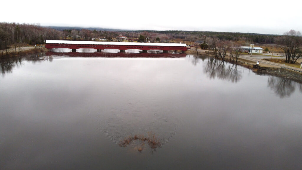
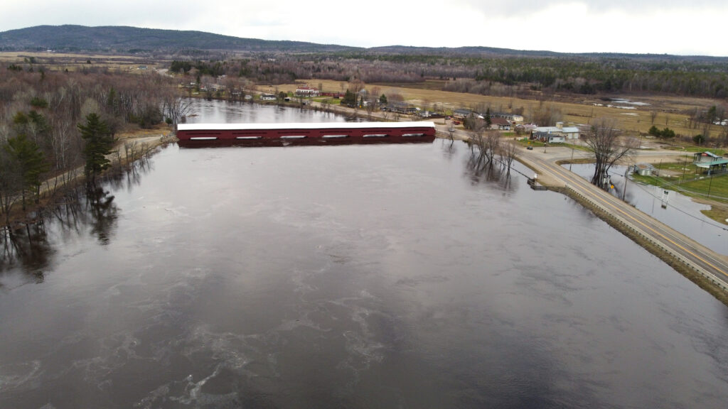
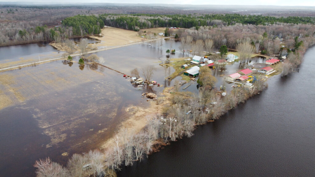
Last week’s heavy rainfall and warm temperatures caused significant snowmelt and spring runoff across the Ottawa River watershed, leading to a surge in river levels from Pembroke, Ont. to Carillon, Que., as well as along the Ottawa’s tributaries.
In many places, the water exceeded major flood levels, defined by the planning board as the level at which one or several streets are beginning to flood, with several houses and buildings or neighbourhoods being affected.
The Apr. 20 update from the Ottawa River Planning Board (the last before this newspaper went to print) forecasted the levels would peak on Tuesday, Apr. 21, at 113.15 metres above sea level in Pembroke, 108.75 m in Lac Coulonge, and 75.85 m in Chats Lake (Quyon).
These are lower than the 2023 peak levels in Pembroke by 10 cm, equal to that year’s peak levels in Lac Coulonge, and 5 cm lower in Chats Lake.
Historical high levels for Pontiac’s stretch of the Ottawa occurred in mid-May of 2019, when they hit 109.17 m in Lac Coulonge and 76.28 m at Chats Lake.
The Apr. 20 forecast suggested levels would then stabilize and slowly decrease over the second half of the week.
But by Monday morning, levels in many places were already at the previously forecasted peak levels for Tuesday. In Lac Coulonge, for example, the planning board’s forecasted Apr. 21 peak level of 108.60 on the Ottawa River had been reached by the morning of Apr. 20.
“We’ve found that the forecasts are not so accurate,” Fort-Coulonge mayor Pierre Cyr told THE EQUITY. “It’s going to go above 108.60 easily, we’re already there. It’s probably going to be more like 108.80 m. It’s [rising] a centimeter an hour right now. [ . . . ] We’re hoping it’s going to stop increasing but there’s no way of knowing for sure. If the water goes to 109 m, we won’t have time to react if it goes that high.”
On Sunday evening, the municipality issued a state of emergency to expedite its ability to respond to the flood.
“We need extra people and a lot of materials, and financially while you’re under the umbrella of the emergency, it will be partly reimbursed,” Cyr explained, adding that operating within a state of emergency enables the municipality to make quick decisions without having to go to council for approval.

Cyr said his main concerns were preventing the flood waters from entering the town’s sewage system, and reducing strain on the water filtration system.
“If the water passes over the roads [ . . . ] it will make our waste and sewage system useless. Then we would have to evacuate the people and it would cause a lot of problems in the basements.” Cyr said, noting the municipality is building several sand dykes in key locations to prevent water from entering its sewage system.
“And the other concern is the water treatment for potable water. Right now it’s having a hard time pumping the water from the river, not because there’s not enough but because there’s a lot of debris and fine particles in the water that impacts the capacity of filtration for it to be potable.”
For this reason, Fort-Coulonge and Mansfield municipalities are asking residents to reduce consumption of drinking water until the end of the flood, to ease pressure on the towns’ water treatment plants.
Over the weekend, the Municipality of Mansfield-et-Pontefract gave evacuation orders to 70 residents and cottagers from streets that had been flooded over the weekend.
“If they need a place to live, well we can fix that, temporarily,” said mayor Sandra Armstrong. On Monday she said unlike neighbouring Fort-Coulonge, Mansfield was not planning to declare a state of emergency.
“Right now we have our emergency plan, we’re using that, and we’re still in our spending budget, so I think right now at 10:34 a.m. on Monday morning, we’re still good with our plan.”
‘Wait and see’ now a spring routine

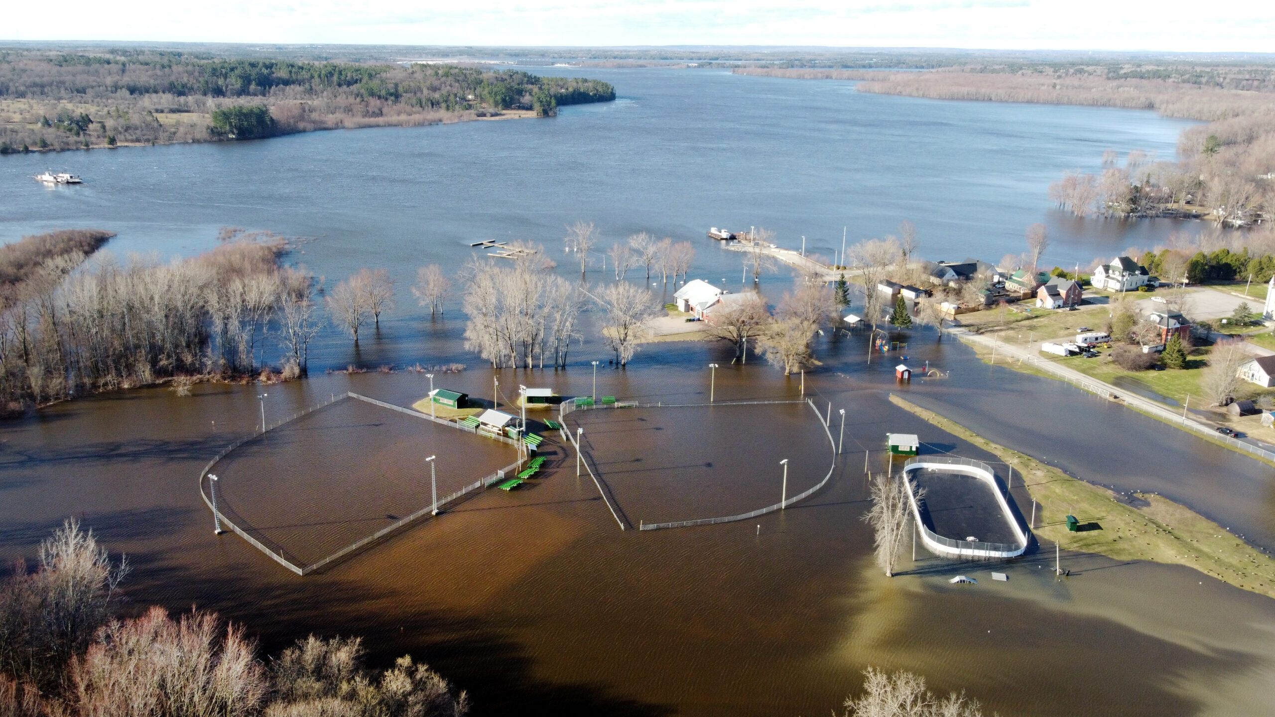
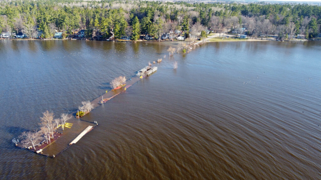
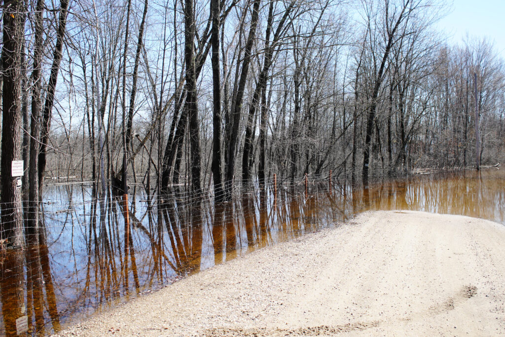
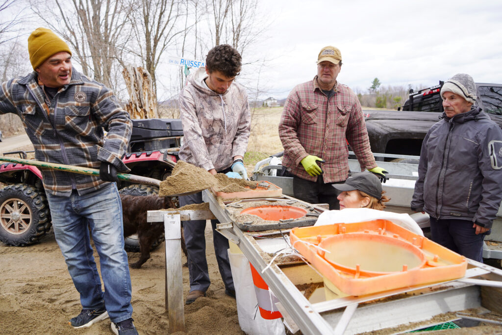
As water levels crept up onto lawns and threatened basements last week, Pontiac residents from Luskville to Sheenboro were hard at work filling sand bags, building dikes and otherwise preparing their homes and properties to withstand possible flooding.
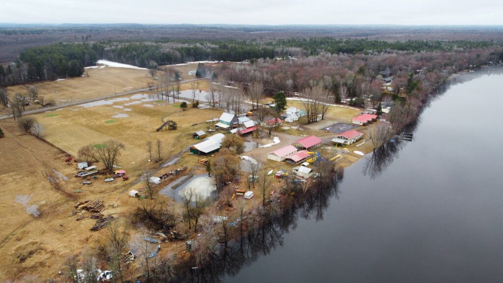
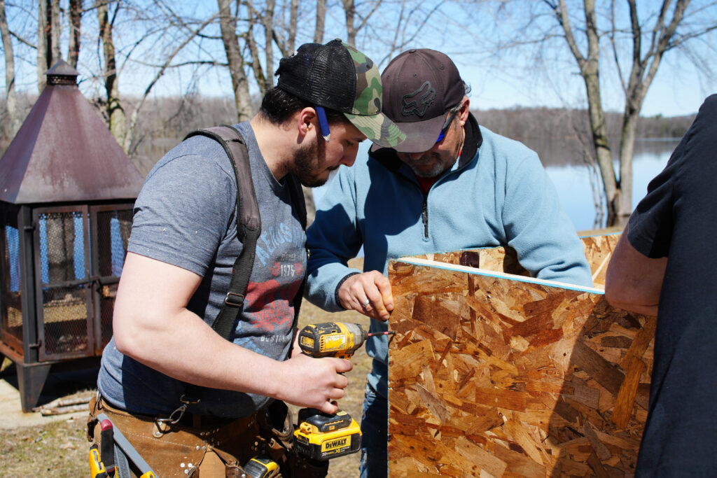
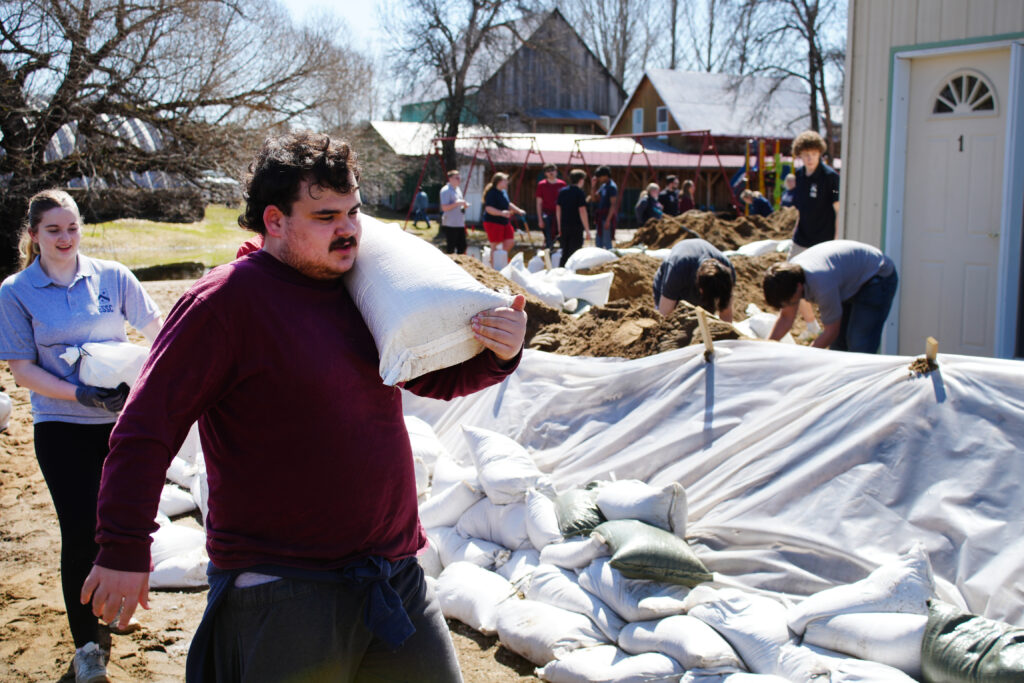
At Le Patro de Fort-Coulonge/Mansfield, an outdoor community centre on the banks of the Ottawa River, over 100 students from École secondaire Sieur-de-Coulonge volunteered to help fill sandbags on Friday.
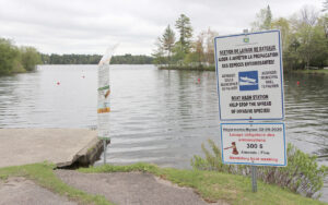
“At 108.5 (metres above sea level) we start to flood,” said Le Patro director Suzie Lavigne, noting the property has flooded every two years since 2017 and no longer benefits from insurance coverage because of its location.
“Each [flooding] event puts our building and equipment in peril, as well as the essential services that we offer to the population,” she wrote in a Facebook post Thursday, calling for community help with filling sand bags.
“We thought we’d try [for help] with the school, and the school sent us around a hundred students. It’s going really well so far,” she said Friday.
Staff and admin were also hard at work assembling and erecting a wooden wall to go inside of the sandbag wall, in case water levels rose above.
“It’s an experiment,” said Jacob Dyelle, who was hard at work putting up the wall. “In 2019, the levels came up to here,” he said, gesturing to a point one-third of the way up a window.
On Monday evening, Lavigne confirmed the various barricades had worked. While Le Patro’s property was largely under water, its infrastructure was protected.
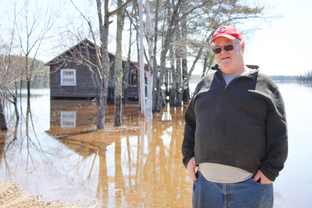
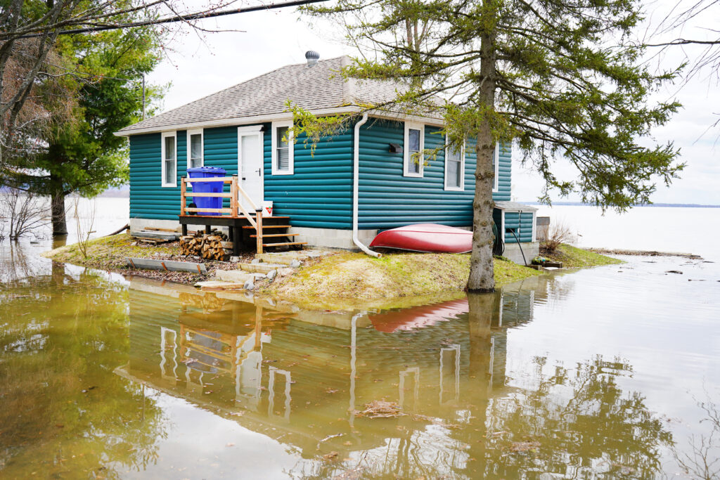
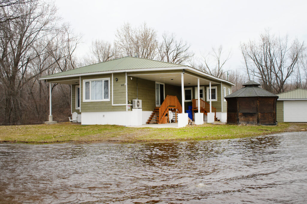
Up the road in Davidson, Kevin Ward spent a large chunk of last week moving belongings out of his basement on rue Thomas-Lefebvre, anticipating the flooding to come.
He uses the basement only for storage, a condition of the flood relief program he benefitted from after the 2019 floods that gave him over $100,000 to raise his house over four feet.
Ward still had to sink about that much of his own money to complete the project, and every year around this time he puts everything on hold, waiting to see where the water levels will land.
“It’s a lot of work, and when it’s all done, you do it in reverse. You put your life on hold for a month to six weeks,” he said on Friday in his basement, which had already begun to accumulate a small pool of water.
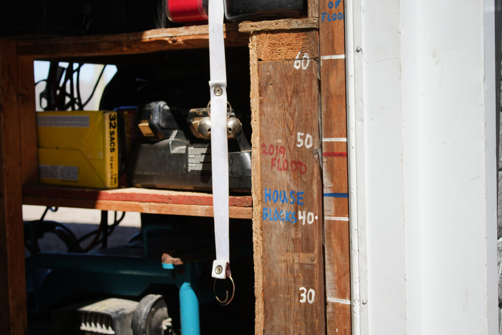
It’s hard for Ward to forget what the high water level was – he has markings on his house and garage as a visual reminder of the 2019 floods. The special shelving he’s since built is designed to be above that high water level.
Ward said he has been happy with the municipality’s response to the flooding over the years, making sure people have the right information and are equipped with sandbags. But he said he would like to see better accountability from the Ottawa River dam operators around how the water levels are controlled.
“Between here and Temiskaming, there’s very few dams and there’s a very sparse population. They could have started 10 years ago, put new dams in there and made large holding reservoirs that don’t affect anybody, then all of us here [in the Pontiac] would be a lot better off,” he said.
The frequency of the floods over the past 10 years means that flood preparation has become a spring habit for even the younger Pontiac residents.
On Sunday morning, just east of Quyon, a small team of cottagers and permanent residents were hard at work filling sand bags and building walls for their properties on chemin Kennedy.
Among them were young Luskville residents Brad Arthurs, a Grade 7 student at Pontiac High School, and Marcus Schoo, a Grade 6 student at Onslow. They spent two days shovelling sand to help protect their neighbours’ homes. For Arthurs, this was not his first time preparing for a flood.
“In 2017, my neighbourhood in Luskville was all flooded out and stuff, so we helped. I was young, so I didn’t really know what was going on.”
Bill Laframboise has lived on chemin Kennedy since 2000.
“You get tired of them,” he said of the frequent floods. “They’re saying it might be like 2017, or it might be like 2023, in terms of amounts, so we’ll have to wait and see.”

Les fortes pluies et les températures chaudes de la semaine dernière ont provoqué une fonte importante des neiges et un ruissellement printanier dans l’ensemble du bassin versant de la rivière des Outaouais, entraînant une montée des niveaux de la rivière de Pembroke (Ont.) à Carillon (Qc), ainsi que le long des affluents de l’Outaouais.
À de nombreux endroits, l’eau a dépassé les niveaux de crue majeurs, définis par la commission de planification comme le niveau auquel une ou plusieurs rues commencent à être inondées, plusieurs maisons et bâtiments ou quartiers étant touchés.
La mise à jour du 20 avril de la Commission de planification de la rivière des Outaouais (la dernière avant la parution de ce journal) prévoyait que les niveaux culmineraient le mardi 21 avril, à 113,15 mètres au-dessus du niveau de la mer à Pembroke, 108,75 m au lac Coulonge et 75,85 m au lac des Chats (Quyon).
Ces niveaux sont inférieurs de 10 cm aux niveaux de crue de 2023 à Pembroke, égaux aux niveaux de crue de cette année-là au lac Coulonge, et inférieurs de 5 cm au lac des Chats.
Les niveaux historiques les plus élevés pour le tronçon de l’Outaouais dans le Pontiac ont été atteints à la mi-mai 2019, à 109,17 m au lac Coulonge et 76,28 m au lac des Chats.
Les prévisions du 20 avril suggéraient que les niveaux se stabiliseraient et diminueraient lentement au cours de la deuxième moitié de la semaine.
Mais le lundi matin, les niveaux à de nombreux endroits avaient déjà atteint les niveaux de crue maximaux prévus pour le mardi. Au lac Coulonge, par exemple, le niveau maximal de 108,60 prévu par la commission de planification pour le 21 avril sur la rivière des Outaouais avait été atteint dès le matin du 20 avril.
« Nous avons constaté que les prévisions ne sont pas très précises, » a déclaré le maire de Fort-Coulonge, Pierre Cyr, à THE EQUITY. « Ça va dépasser 108,60 facilement, nous y sommes déjà. Ce sera probablement plus comme 108,80 m. Ça [monte] d’un centimètre à l’heure en ce moment. [ . . . ] Nous espérons que ça va arrêter d’augmenter, mais il n’y a aucun moyen de le savoir avec certitude. Si l’eau monte à 109 m, nous n’aurons pas le temps de réagir si ça monte aussi haut. »
Le dimanche soir, la municipalité a décrété l’état d’urgence afin d’accélérer sa capacité à répondre à l’inondation.
« Nous avons besoin de personnel supplémentaire et de beaucoup de matériel, et financièrement, tant que vous êtes sous le couvert de l’urgence, cela sera partiellement remboursé, » a expliqué M. Cyr, ajoutant que le fait d’opérer en état d’urgence permet à la municipalité de prendre des décisions rapides sans avoir à obtenir l’approbation du conseil.
M. Cyr a dit que ses principales préoccupations étaient d’empêcher les eaux de crue de pénétrer dans le système d’égouts de la ville et de réduire la pression sur le système de filtration de l’eau.
« Si l’eau passe par-dessus les routes [ . . . ] cela rendra notre système de collecte des eaux usées et d’égouts inutilisable. Nous devrions alors évacuer les gens et cela causerait beaucoup de problèmes dans les sous-sols, » a déclaré M. Cyr, notant que la municipalité construit plusieurs digues de sable à des endroits clés pour empêcher l’eau de pénétrer dans son système d’égouts.
« L’autre préoccupation concerne le traitement de l’eau potable. Actuellement, il est difficile de pomper l’eau de la rivière, non pas parce qu’il n’y en a pas assez, mais parce qu’il y a beaucoup de débris et de fines particules dans l’eau, ce qui a un impact sur la capacité de filtration pour qu’elle soit potable. »
Pour cette raison, les municipalités de Fort-Coulonge et de Mansfield demandent aux résidents de réduire leur consommation d’eau potable jusqu’à la fin de la crue, afin de soulager la pression sur les usines de traitement de l’eau des villes.
Au cours du week-end, la Municipalité de Mansfield-et-Pontefract a émis des ordres d’évacuation pour 70 résidents et propriétaires de chalets des rues qui avaient été inondées au cours du week-end.
« S’ils ont besoin d’un endroit où vivre, eh bien nous pouvons régler ça, temporairement, » a déclaré la mairesse Sandra Armstrong. Lundi, elle a déclaré que, contrairement à la ville voisine de Fort-Coulonge, Mansfield n’avait pas l’intention de décréter l’état d’urgence.
« Pour l’instant, nous avons notre plan d’urgence, nous l’utilisons, et nous sommes toujours dans notre budget de dépenses, donc je pense qu’à 10 h 34, ce lundi matin, nous sommes toujours bien avec notre plan. »
L’« attentisme » est maintenant une routine printanière
Alors que les niveaux d’eau montaient sur les pelouses et menaçaient les sous-sols la semaine dernière, les résidents du Pontiac, de Luskville à Sheenboro, s’affairaient à remplir des sacs de sable, à construire des digues et à préparer autrement leurs maisons et leurs propriétés à résister à d’éventuelles inondations.
Au Patro de Fort-Coulonge/Mansfield, un centre communautaire extérieur situé sur les rives de la rivière des Outaouais, plus de 100 élèves de l’École secondaire Sieur-de-Coulonge se sont portés volontaires pour aider à remplir des sacs de sable vendredi.
« À 108,5 (mètres au-dessus du niveau de la mer), nous commençons à être inondés, » a déclaré Suzie Lavigne, directrice du Patro, notant que la propriété a été inondée tous les deux ans depuis 2017 et ne bénéficie plus d’une couverture d’assurance en raison de son emplacement.
« Chaque événement [d’inondation] met en péril notre bâtiment et notre équipement, ainsi que les services essentiels que nous offrons à la population, » a-t-elle écrit dans un message Facebook jeudi, demandant l’aide de la communauté pour le remplissage des sacs de sable.
« Nous avons pensé essayer [d’obtenir de l’aide] auprès de l’école, et l’école nous a envoyé une centaine d’élèves. Ça se passe très bien jusqu’à présent, » a-t-elle déclaré vendredi.
Le personnel et l’administration travaillaient également d’arrache-pied à assembler et à ériger un mur en bois qui irait à l’intérieur du mur de sacs de sable, au cas où les niveaux d’eau monteraient plus haut.
« C’est une expérience, » a déclaré Jacob Dyelle, qui s’affairait à ériger le mur. « En 2019, les niveaux sont montés jusqu’ici, » a-t-il dit, en désignant un point situé au tiers de la hauteur d’une fenêtre.
Lundi soir, Mme Lavigne a confirmé que les diverses barricades avaient fonctionné. Alors que la propriété du Patro était en grande partie sous l’eau, son infrastructure était protégée.
Plus loin sur la route à Davidson, Kevin Ward a passé une grande partie de la semaine dernière à déménager ses biens de son sous-sol sur la rue Thomas-Lefebvre, anticipant les inondations à venir.
Il utilise le sous-sol uniquement pour l’entreposage, une condition du programme d’aide aux sinistrés dont il a bénéficié après les inondations de 2019, qui lui ont donné plus de 100 000 $ pour surélever sa maison de plus de quatre pieds.
M. Ward a tout de même dû investir à peu près autant de son propre argent pour réaliser le projet, et chaque année à cette période, il met tout en suspens, attendant de voir où les niveaux d’eau se situeront.
« C’est beaucoup de travail, et quand tout est terminé, vous le faites en sens inverse. Vous mettez votre vie en veille pendant un mois à six semaines, » a-t-il déclaré vendredi dans son sous-sol, qui avait déjà commencé à accumuler une petite mare d’eau.
Il est difficile pour M. Ward d’oublier le niveau élevé de l’eau – il a des marques sur sa maison et son garage comme rappel visuel des inondations de 2019. Les étagères spéciales qu’il a construites depuis sont conçues pour être au-dessus de ce niveau d’eau élevé.
M. Ward a déclaré qu’il était satisfait de la réponse de la municipalité aux inondations au fil des ans, s’assurant que les gens disposent des bonnes informations et soient équipés de sacs de sable. Mais il a ajouté qu’il aimerait voir une meilleure responsabilisation de la part des exploitants de barrages de la rivière des Outaouais concernant la façon dont les niveaux d’eau sont contrôlés.
« Entre ici et Témiscaming, il y a très peu de barrages et une population très éparse. Ils auraient pu commencer il y a 10 ans, y installer de nouveaux barrages et créer de grands réservoirs de rétention qui n’affectent personne, alors nous tous ici [dans le Pontiac] serions beaucoup mieux lotis, » a-t-il déclaré.
La fréquence des inondations au cours des 10 dernières années signifie que la préparation aux crues est devenue une habitude printanière même pour les jeunes résidents du Pontiac.
Le dimanche matin, juste à l’est de Quyon, une petite équipe de propriétaires de chalets et de résidents permanents s’affairait à remplir des sacs de sable et à construire des murs pour leurs propriétés sur le chemin Kennedy.
Parmi eux se trouvaient de jeunes résidents de Luskville, Brad Arthurs, un élève de 7e année de l’école secondaire Pontiac High School, et Marcus Schoo, un élève de 6e année d’Onslow. Ils ont passé deux jours à pelleter du sable pour aider à protéger les maisons de leurs voisins. Pour Arthurs, ce n’était pas sa première fois à se préparer à une inondation.
« En 2017, mon quartier à Luskville était tout inondé et tout ça, alors nous avons aidé. J’étais jeune, alors je ne savais pas vraiment ce qui se passait. »
Bill Laframboise vit sur le chemin Kennedy depuis 2000.
« On en a assez, » a-t-il dit à propos des inondations fréquentes. « Ils disent que ça pourrait être comme en 2017, ou ça pourrait être comme en 2023, en termes de quantités, alors il faudra attendre et voir. »