
*This story was last updated on Apr. 17 at 5:15 p.m.
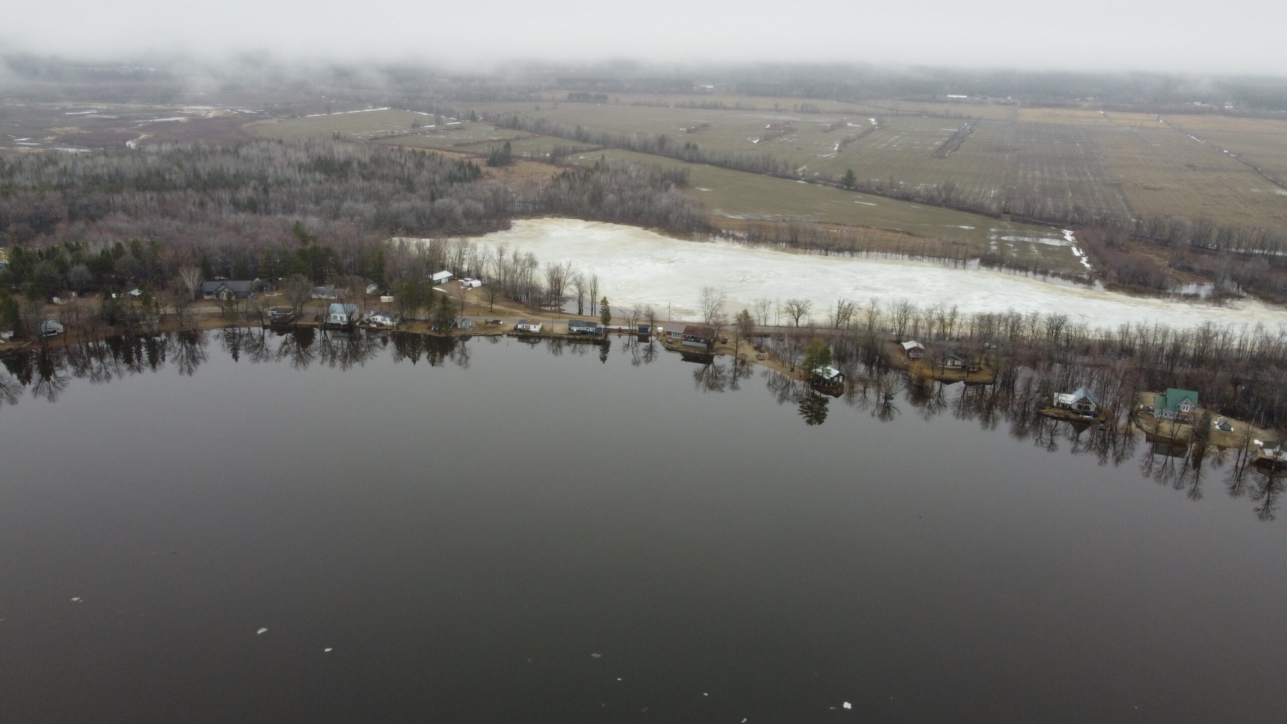
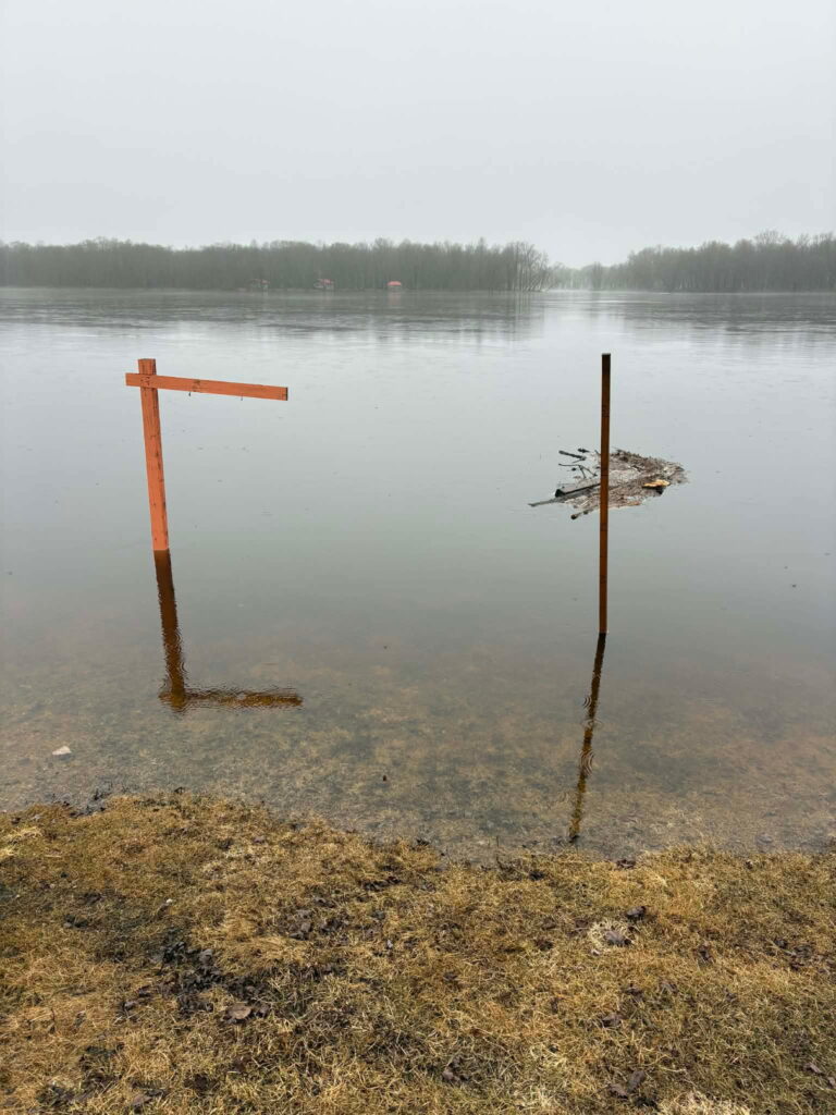
Riverfront communities across the Pontiac are bracing for high water levels expected this weekend after a week of rain and warm temperatures have caused significant snow melt.
In an updated forecast published Apr. 17 at 4:40 p.m., the Ottawa River Planning Board said minor flood levels have been exceeded in most flood prone areas from Pembroke to Carillon, and that major flood levels may be exceeded over the weekend, depending on weather.
It also warned that weather forecasts are uncertain at this time, and that major flood levels from Lac Coulonge to Masson/Cumberland may be exceeded over the weekend.
The planning board defines the minor flood level as that at which parts of some streets, lawns and parks are beginning to flood, with no or few houses/buildings being affected.
The major flood level is defined as that at which one or several streets are beginning to flood, with several houses/buildings or neighbourhoods being affected.
Apr. 17 water levels were 107.97 at Lac Coulonge (Fort-Coulonge) and 75.21 at Chats Lake (Quyon).
The planning board’s four-day forecast said that by Monday, river levels could reach as high as 108.40 in Lac Coulonge, and 75.45 in Chats Lake.
It said water levels should begin stabilizing by Monday.
Residents can monitor river levels and flood forecasts at ottawariver.ca. Updates are posted every day around 4 p.m..

Municipalities that often see significant flooding are advising residents to take necessary precautions and protect vulnerable property.
In the Municipality of Pontiac, sand bags are available at the town hall on Highway 148 in Luskville and at the municipal garage in Quyon. Municipal workers are also planning to deliver some sand and sand bags to areas that regularly flood.
“After so many years, we know pretty well who gets flooded first, and we’re in contact with them, and they contact me right away when they get close,” said mayor Roger Larose, noting that by Thursday afternoon, nobody’s property was underwater.
“They’re just getting close, they’re scared, but nothing bad yet.”
L’Isle-aux-Allumettes is making sand bags available in limited quantities at the municipal garage located at 450 chemin du Rang 5. In a Facebook post it said primary residences will be prioritized, and sand bags are not intended for secondary buildings such as sheds and garages.
In an update posted to Facebook Friday morning, the Municipality of Mansfield-et-Pontefract said it had officially activated its Emergency Measures Plan, which includes the mobilization of municipal staff in at-risk sectors, and activation of a municipal coordination cell.
“The decision was made because of the high level of uncertainty in current hydrological forecasts, which indicate a sustained upward trend in water levels,” the update states.
Sand and sand bags are being made available at the municipal quarry, located at 32 chemin du Lac de la Truite. Residents able to volunteer their time to fill bags, or those requiring sand bags, are invited to call the department coordinator at 613-401-7925.

In other municipalities sand bags are available at the boat launch in Sand Bay, Clarendon, at the ball field in Waltham, at the corner of Wharf and River roads in Norway Bay, and the access way in Pontiac Station.
Suzie Lavigne, director of Le Patro de Fort-Coulonge/Mansfield, was among those preparing their properties for the worst case scenario on Thursday afternoon.
The outdoor community centre, located on chemin de la Passe in Mansfield right on the river’s edge, is familiar with the now routine process of securing its facilities for spring flooding. Located in a flood zone, it has not qualified for flood insurance since the 2019 flood.
“It’s very stressful, not just for me but for the team too. We’re unsure of what’s going on. We’re trying to ensure the security of our property, to save what we have,” Lavigne said.
“We’ve started the preparation of our dikes. We have two pavilions where if the levels rise to what they’re predicted to be on Saturday, they’ll be flooded. So we’ve already started with the sandbags, and our pumps.”
She said she’s used to seeing these water levels around the beginning of May, but not usually by mid-April.
“We’re just Apr. 16 and the levels are already very high, so it’s not looking good. [ . . . ] If it’s supposed to be the peak that they’re calling for Saturday, we’ll have a lot of water here.”
Road closures
Several roads have flooded or been washed out across the territory. Below are the public roads closed as of Apr. 16 at 9 a.m.
Thorne:
- Chemin Bryson between chemin Brouse and chemin Anderson
- Thorne Lake Road is also closed. If you need to travel, please use Wesley or 12th Line as alternate routes.
- Mountain Road is practically impassable due to a cleanup operation underway involving heavy machinery
- The 366 between Ladysmith and Lac-des-Loups has significant flooding
Waltham:
- Black River Road is now closed to traffic as of Trout Lake Road as there is about four inches of water on the road between Kilometre 12 and Kilometer 15. In some places the water is nine inches deep.
In an Apr. 17 update, Mansfield-et-Pontefract said the following roads have between 10 and 15 cm of water on them:
- chemin Léonard, leaving about five cottages and one residence isolated
- chemin Félix, leaving one cottage isolated
- chemin Bélec, leaving one cottage isolated
- chemin Esprit, leaving eight cottages and two residences isolated
If you know of a road closure that should be in this list, please be in touch with editor@theequity.ca.
*Cette histoire a été mise à jour le 17 avril à 17 h 15.
Les communautés riveraines du Pontiac se préparent à des niveaux d’eau élevés prévus ce week-end après une semaine de pluie et de températures chaudes ayant provoqué une fonte des neiges importante.
Dans des prévisions mises à jour, publiées le 17 avril à 16 h 40, la Commission de planification de la rivière des Outaouais a déclaré que les niveaux de crue mineurs avaient été dépassés dans la plupart des zones sujettes aux inondations de Pembroke à Carillon, et que les niveaux de crue majeurs pourraient être dépassés au cours du week-end, selon les conditions météorologiques.
Elle a également averti que les prévisions météorologiques sont incertaines à l’heure actuelle, et que les niveaux de crue majeurs du lac Coulonge à Masson/Cumberland pourraient être dépassés au cours du week-end.
La commission de planification définit le niveau de crue mineur comme celui où des parties de certaines rues, pelouses et parcs commencent à être inondées, avec peu ou pas de maisons/bâtiments affectés.
Le niveau de crue majeur est défini comme celui où une ou plusieurs rues commencent à être inondées, avec plusieurs maisons/bâtiments ou quartiers affectés.
Le 17 avril, les niveaux d’eau étaient de 107,97 au lac Coulonge (Fort-Coulonge) et de 75,21 au lac des Chats (Quyon).
Les prévisions sur quatre jours de la commission de planification indiquent que d’ici lundi, les niveaux de la rivière pourraient atteindre 108,40 au lac Coulonge et 75,45 au lac des Chats.
Elle a précisé que les niveaux d’eau devraient commencer à se stabiliser d’ici lundi.
Les résidents peuvent surveiller les niveaux de la rivière et les prévisions d’inondation sur ottawariver.ca. Les mises à jour sont publiées tous les jours vers 16 h.
Les municipalités qui connaissent souvent des inondations importantes conseillent aux résidents de prendre les précautions nécessaires et de protéger les propriétés vulnérables.
Dans la Municipalité de Pontiac, des sacs de sable sont disponibles à l’hôtel de ville, sur la route 148 à Luskville, et au garage municipal à Quyon. Les employés municipaux prévoient également de livrer du sable et des sacs de sable dans les zones régulièrement inondées.
« Après tant d’années, nous savons assez bien qui est inondé en premier, et nous sommes en contact avec eux, et ils me contactent immédiatement quand ça approche », a déclaré le maire Roger Larose, notant que jeudi après-midi, aucune propriété n’était sous l’eau.
« Ça approche, ils sont inquiets, mais rien de grave pour l’instant. »
L’Isle-aux-Allumettes met des sacs de sable à disposition en quantités limitées au garage municipal situé au 450, chemin du Rang 5. Dans une publication Facebook, elle a précisé que les résidences principales seront prioritaires et que les sacs de sable ne sont pas destinés aux bâtiments secondaires comme les cabanons et les garages.
Dans une mise à jour publiée sur Facebook vendredi matin, la Municipalité de Mansfield-et-Pontefract a déclaré avoir officiellement activé son Plan de mesures d’urgence, qui comprend la mobilisation du personnel municipal dans les secteurs à risque et l’activation d’une cellule de coordination municipale.
« La décision a été prise en raison du niveau élevé d’incertitude dans les prévisions hydrologiques actuelles, qui indiquent une tendance à la hausse soutenue des niveaux d’eau », indique la mise à jour.
Du sable et des sacs de sable sont mis à disposition à la carrière municipale, située au 32, chemin du Lac de la Truite. Les résidents désireux de faire du bénévolat pour remplir des sacs, ou ceux qui ont besoin de sacs de sable, sont invités à appeler le coordonnateur du département au 613 401-7925.
Dans d’autres municipalités, des sacs de sable sont disponibles à la rampe de mise à l’eau de Sand Bay, à Clarendon, au terrain de balle de Waltham, au coin des chemins Wharf et River à Norway Bay, et à l’accès à la Station Pontiac.
Suzie Lavigne, directrice du Patro de Fort-Coulonge/Mansfield, était parmi ceux qui préparaient leurs propriétés pour le pire des scénarios jeudi après-midi.
Le centre communautaire extérieur, situé sur le chemin de la Passe à Mansfield, juste au bord de la rivière, est habitué au processus désormais routinier de sécurisation de ses installations en prévision des crues printanières. Situé dans une zone inondable, il n’est plus admissible à l’assurance inondation depuis la crue de 2019.
« C’est très stressant, non seulement pour moi, mais aussi pour l’équipe. Nous ne sommes pas certains de ce qui va se passer. Nous essayons d’assurer la sécurité de notre propriété, de sauver ce que nous avons », a déclaré Mme Lavigne.
« Nous avons commencé la préparation de nos digues. Nous avons deux pavillons où, si les niveaux montent à ce qu’ils sont prévus pour samedi, ils seront inondés. Nous avons donc déjà commencé avec les sacs de sable et nos pompes. »
Elle a dit avoir l’habitude de voir ces niveaux d’eau vers le début mai, mais pas habituellement à la mi-avril.
« Nous sommes seulement le 16 avril et les niveaux sont déjà très élevés, donc ce n’est pas de bon augure. [ . . . ] Si c’est censé être le pic qu’ils annoncent pour samedi, nous aurons beaucoup d’eau ici. »
Fermetures de routes
Plusieurs routes ont été inondées ou emportées sur le territoire. Voici les routes publiques fermées au 16 avril à 9 h.
Thorne :
- Chemin Bryson entre le chemin Brouse et le chemin Anderson
- Thorne Lake Road est également fermé. Si vous devez vous déplacer, veuillez utiliser Wesley ou la 12e Ligne comme itinéraires alternatifs.
- La Mountain Road est pratiquement impraticable en raison d’une opération de nettoyage en cours impliquant de la machinerie lourde.
- La 366 entre Ladysmith et Lac-des-Loups est fortement inondée.
Waltham :
- La Black River Road est maintenant fermée à la circulation à partir de Trout Lake Road, car il y a environ quatre pouces d’eau sur la route entre les kilomètres 12 et 15. À certains endroits, l’eau atteint neuf pouces de profondeur.
Dans une mise à jour du 17 avril, Mansfield-et-Pontefract a déclaré que les routes suivantes ont entre 10 et 15 cm d’eau :
- chemin Léonard, laissant environ cinq chalets et une résidence isolés ;
- chemin Félix, laissant un chalet isolé ;
- chemin Bélec, laissant un chalet isolé ;
- chemin Esprit, laissant huit chalets et deux résidences isolés.
Si vous connaissez une fermeture de route qui devrait figurer sur cette liste, veuillez communiquer avec editor@theequity.ca.